
217 E. Lime Avenue
KNOWN DETAILS

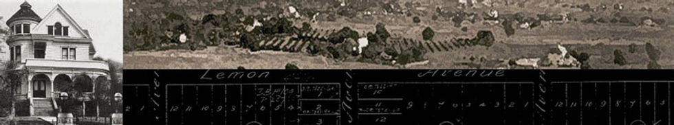
The map shows 217 E. Lime Avenue as a very small house on a double lot.

This map shows the addition to the back of the property that Mabel Menefee used as a rental.

This shot is looking east where the structures on Lots17-21 were located.
The map shows 217 E. Lime Avenue as a very small house on a double lot.
Description
The 1888 tax record shows J.C. Anderson as the first owner of Lot 17, which was valued at $300 at that time. He held on to the property as its value dropped until 1901 when the property was sold to Mary Sergeant who owned it for two years. She did not improve the property and its value stayed at $75 for the two years she owned it. We were unable to find anything substantial about her.
By 1904, the value had increased to $150 and Cora M. Graves purchased it and built a house on it (see 1907 Sanborn map) valued at $400. In 1906, Mabel Menefee bought the property which had increased in value to $350. The address of Lot 17 became 217 E. Lime Avenue. The 1913 Sanborn map shows an additional small dwelling with an address of 217 1/2. This structure may have been torn down as there is a building permit, dated 1949, issued to Miss Menefee for a residence at the 217 1/2 address.
The 1927 Sanborn map shows a substantial dwelling at the back of Lot 17. It also shows the neignborhood before the houses on most of the other lots were torn down to be replaced by a parking lot. The rest of the parking area is made up of Lots 18, 19, and 20. The houses on these lots were also town down.
As far as tenants who lived at 2117 E. Lime Avenue, the 1908-1909 Monrovia Directory lists C. Frank Jackson, a lineman for the Monrovia Telephone and Telegraph Company, as renting 217 E. Lime. The 1911 Monrovia Directory lists Mabel C. Menefee as living at 217 E. Lime. Later directories list her as an office nurse, working for Dr. J.K. Sewell. Ms. Menefee may have rented out a room of her house, a not uncommon practice, as the 1916-1917 directory lists Anna J. Sewright living at the address but only one for year.
In the 1926-27 directory, a Miss Estelle M. Nelson, a clerk McBratney's is listed as living at this address. Mabel Menefee may have moved to the back house, but she lived on Lot 17 until the end of her life in 1950.
The residence zone for Lot 17 was changed in 1960, as the first step in tearing down the house. In 1962, a Planning Commission Architectural review states that Lot 17 was 50 x 160 feet. It did not conform to building code or zoning ordinances, and was at least 50 years old, as if age were some kind of crime. The house was razed and it and the most of the other lots became a parking lot.
Because there are no pictures of this dwelling, the exact architectural style is not known. But because a dwelling appears on the 1907 Sanborn map, it might be surmised that the house's architecture was similar to those on the rest of block which appear at the same time and are still standing.
That would it an early Craftsman with Victorian elements.